This is a Golang package to translate between Ordnance Survey (OS) Grid References and Latitude / Longitude. OS Grid references are traditionally used in UK navigation, while lat / lon is used by GPS systems and global mapping systems.
This package is a partial translation into Golang of the excellent Javascript library by Chris Veness.
gridRef, err := ParseOsGridRef("SW 46760 28548")
if err != nil {
    panic(err)
}

lat, lon := gridRef.ToLatLon()
fmt.Printf("%.4f,%.4fn", lat, lon)     // 50.1029,-5.5428
There are more detailed examples on pkg.go.dev, or try it in the Go Playground.

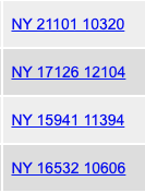
The Ordnance Survey have been producing maps of Great Britain since 1791. They use a National Grid system, distinct from latitude and longitude, where grid references comprise two letters and a sequence of digits, such as "SK127836".
OS grid references are ubiquitous in the great outdoors - guide books use them to tell you where to park the car, hiking routes use them, and should you get into trouble the local Mountain Rescue team would want to know the location as an OS grid ref. However, the OS grid is only relevant in Great Britain; most electronic and global mapping systems instead use Latitude and Longitude, as in, for example, this Google Maps URL.
So sometimes it is necessary to convert between OS grid refs and lat/lon references. This Golang library can be used to perform the conversion.

The normal, human-readable representation is two letters followed by two groups of digits,
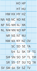
for example SZ 644 874. The 2 letters define a 100 km by 100 km square, as in the diagram
on the right. The first group of digits isthe eastings and the second is the northings;
these digits define a coordinate within the 100 km square.
An alternative notation is to omit the grid letters and provide just an easting and northing
separated by a comma. In this case these are coordinates relative to the origin of the grid
as a whole, i.e. relative to the south-west corner of the grid.
The Ordnance Survey have created a friendly guide with full details.
This library can parse and display both types of representation.
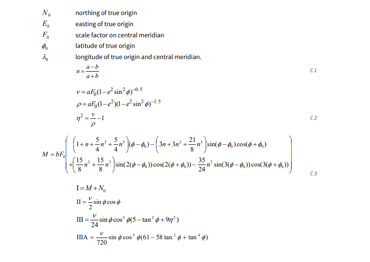
It's difficult. Very, very difficult. Pages of this sort of stuff:

(an excerpt from page 50 of the Ordnance Survey's reference guide)
Fortunately Chris Veness has already done the hard work of implementing this in his Javascript library (which does much more than just converting grid ref to and from lat/lon). This package is a fairly mechanical translation of the Javascript into Golang, without understanding how it works.
I am pleased to say that I don't understand the mathematics behind any of this.
This is deliberate, to make it easier to verify this implementation against the original Javascript implementation. Where possible, each line of upstream code should match against an equivalent line in the Golang code.