Google Direction Api
1.6
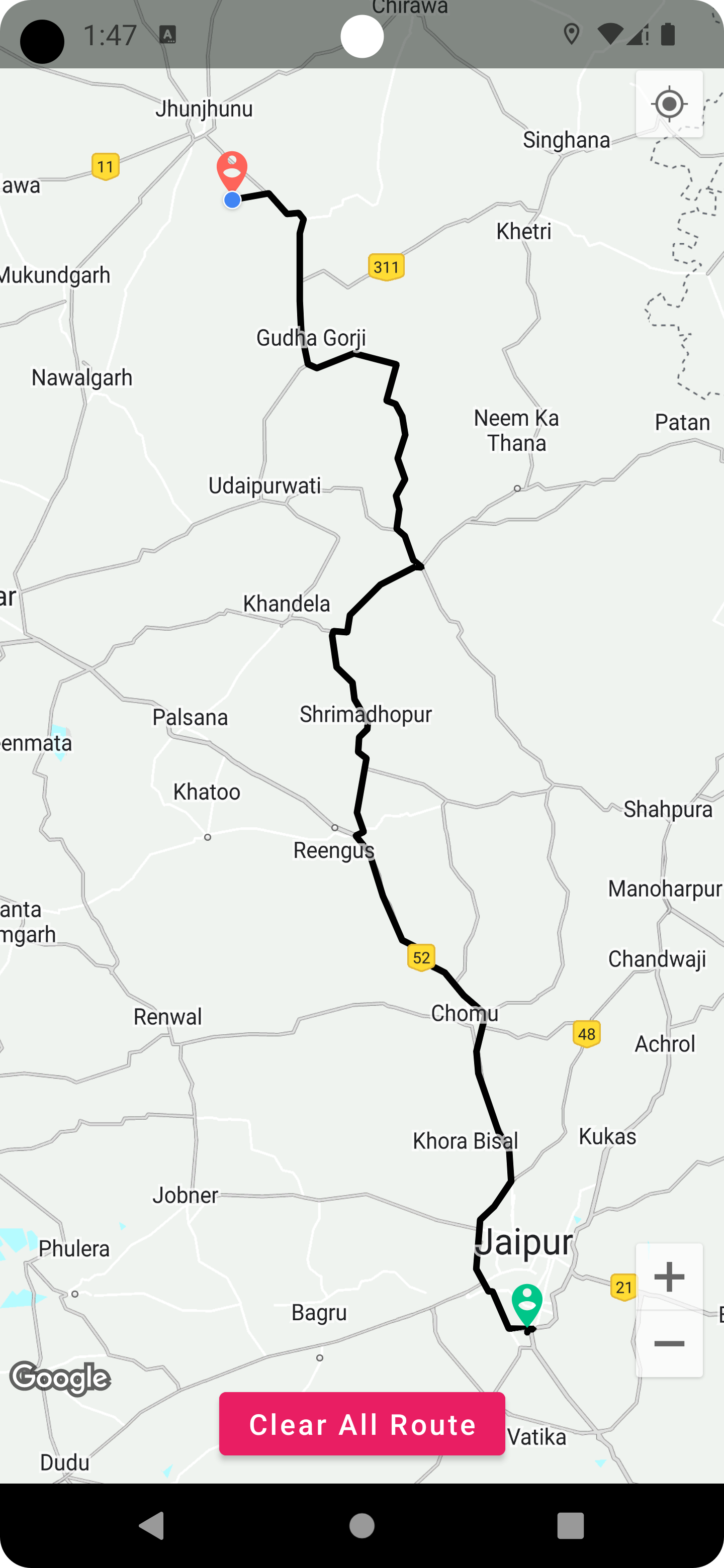
นี่คือไลบรารี Android ที่ให้เส้นทางทิศทางระหว่างสองจุด (ตำแหน่ง) เช่นตำแหน่งอุปกรณ์ไปยังตำแหน่งปลายทาง หากต้องการใช้ไลบรารีนี้ คุณต้องสร้างโปรเจ็กต์บน Goolge Cloud Console และเปิดใช้งาน Map SDK ร่วมกับ Google Direction Api หลังจากเสร็จสิ้นการตั้งค่าทั้งหมด เพียงทำตามขั้นตอนง่ายๆ เหล่านี้เพื่อนำโค้ดไปใช้งานในโปรเจ็กต์ของคุณ
 | คลิกเพื่อดูวิดีโอสาธิต หรือ Youtube Tutotial ของการนำไปปฏิบัติ |
| ภาพ | วิดีโอสาธิต |
เพิ่มที่เก็บ jitpack ในไฟล์ build.gradle (ระดับโครงการ) ของคุณ:
 allprojects {
      repositories {
	.. .
	maven { url ' https://jitpack.io ' }
	}
} ใน settings.gradle ของคุณ
 dependencyResolutionManagement {
    repositoriesMode . set( RepositoriesMode . FAIL_ON_PROJECT_REPOS )
    repositories {
        .. .
        maven { url " https://jitpack.io " }
    }
} เพิ่มการพึ่งพาในไฟล์ build.gradle (ระดับโมดูล) ของคุณ:
dependencies {
	  implementation ' com.github.dangiashish:Google-Direction-Api:1.6 '
} public void getRoutePoints ( LatLng start , LatLng end ) {
if ( start == null || end == null ) {
Toast . makeText ( this , "Unable to get location" , Toast . LENGTH_LONG ). show ();
Log . e ( "TAG" , " latlngs are null" );
} else {
RouteDrawing routeDrawing = new RouteDrawing . Builder ()
. context ( MainActivity . this ) // pass your activity or fragment's context
. travelMode ( AbstractRouting . TravelMode . DRIVING )
. withListener ( this ). alternativeRoutes ( true )
. waypoints ( userLoc , destLoc )
. build ();
routeDrawing . execute ();
}
} ใช้คลาสอินเทอร์เฟซ RouteListener ใน Activity/Fragment ของคุณเพื่อแทนที่การดำเนินการ
 @ Override
public void onRouteFailure ( ErrorHandling e ) {
    Log . w ( "TAG" , "onRoutingFailure: " + e );
} @ Override
public void onRouteStart () {
Log . d ( "TAG" , "yes started" );
}
 @ Override
public void onRouteSuccess ( ArrayList < RouteInfoModel > routeInfoModelArrayList , int routeIndexing ) {
     if ( polylines != null ) {
         polylines . clear ();
     }
     PolylineOptions polylineOptions = new PolylineOptions ();
     ArrayList < Polyline > polylines = new ArrayList <>();
     for ( int i = 0 ; i < routeInfoModelArrayList . size (); i ++) {
         if ( i == routeIndexing ) {
             Log . e ( "TAG" , "onRoutingSuccess: routeIndexing" + routeIndexing );
             polylineOptions . color ( Color . BLACK );
             polylineOptions . width ( 12 );
             polylineOptions . addAll ( routeInfoModelArrayList . get ( routeIndexing ). getPoints ());
             polylineOptions . startCap ( new RoundCap ());
             polylineOptions . endCap ( new RoundCap ());
             Polyline polyline = map . addPolyline ( polylineOptions );
             polylines . add ( polyline );
	  }
     }

} @ Override
public void onRouteCancelled () {
Log . d ( "TAG" , "route canceled" )
// restart your route drawing
} MIT License
Copyright (c) 2023 Ashish Dangi
Permission is hereby granted, free of charge, to any person obtaining a copy
of this software and associated documentation files (the "Software"), to deal
in the Software without restriction, including without limitation the rights
to use, copy, modify, merge, publish, distribute, sublicense, and/or sell
copies of the Software, and to permit persons to whom the Software is
furnished to do so, subject to the following conditions:
The above copyright notice and this permission notice shall be included in all
copies or substantial portions of the Software.
THE SOFTWARE IS PROVIDED "AS IS", WITHOUT WARRANTY OF ANY KIND, EXPRESS OR
IMPLIED, INCLUDING BUT NOT LIMITED TO THE WARRANTIES OF MERCHANTABILITY,
FITNESS FOR A PARTICULAR PURPOSE AND NONINFRINGEMENT. IN NO EVENT SHALL THE
AUTHORS OR COPYRIGHT HOLDERS BE LIABLE FOR ANY CLAIM, DAMAGES OR OTHER
LIABILITY, WHETHER IN AN ACTION OF CONTRACT, TORT OR OTHERWISE, ARISING FROM,
OUT OF OR IN CONNECTION WITH THE SOFTWARE OR THE USE OR OTHER DEALINGS IN THE
SOFTWARE.